Increase Efficiency
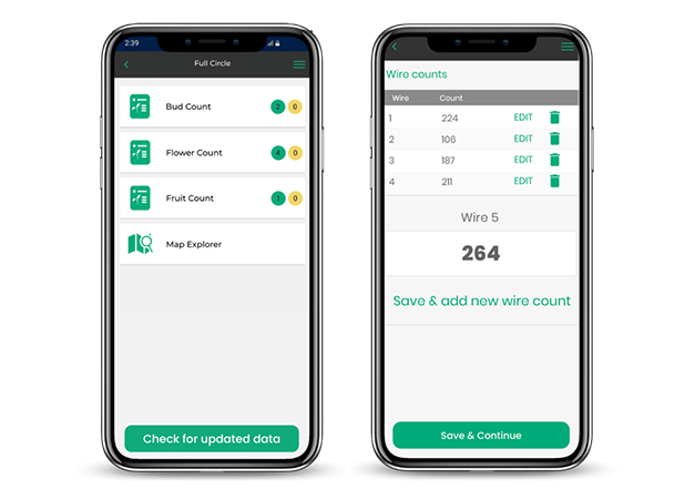
With crop counts seamlessly syncing with the platform, Landkind decreases the need for paper and reduces duplication of data, supporting quicker crop management decisions.
We'd love to show you how the platform works.
Fill in the form below, and one of our team will be in touch.
Watch More
Define and draw in monitoring bays right on your maps using the web app.
Then, teams can use the mobile app to locate and navigate monitoring bays easily for counting.
.png?width=1520&height=1080&name=laptop%20(3).png)
Team members can enter counts anytime, from any location.
Counts are created against established monitoring bays, or teams can enter a count directly against a specific block. Also, view a summary of all counts for a property from within the app.

Using the counts collected by bay, Landkind will automatically calculate the average crop density for each block.
Visualise and compare crop estimates from season-to-season to support on orchard crop management decisions.
.png?width=1520&height=1080&name=laptop%20various%20(3).png)
With crop counts seamlessly syncing with the platform, Landkind decreases the need for paper and reduces duplication of data, supporting quicker crop management decisions.
No reception in the orchard? No worries. Users can enter counts without reception, and the data can be synchronised once they have service.
Visualise a summary of all counts that have been entered for a property, regardless of who entered them, using our Crop Count Summary tool.
